Drone Photography in Fayetteville, NC
Professional aerial images that show scale, location, and detail you can’t capture from the ground.
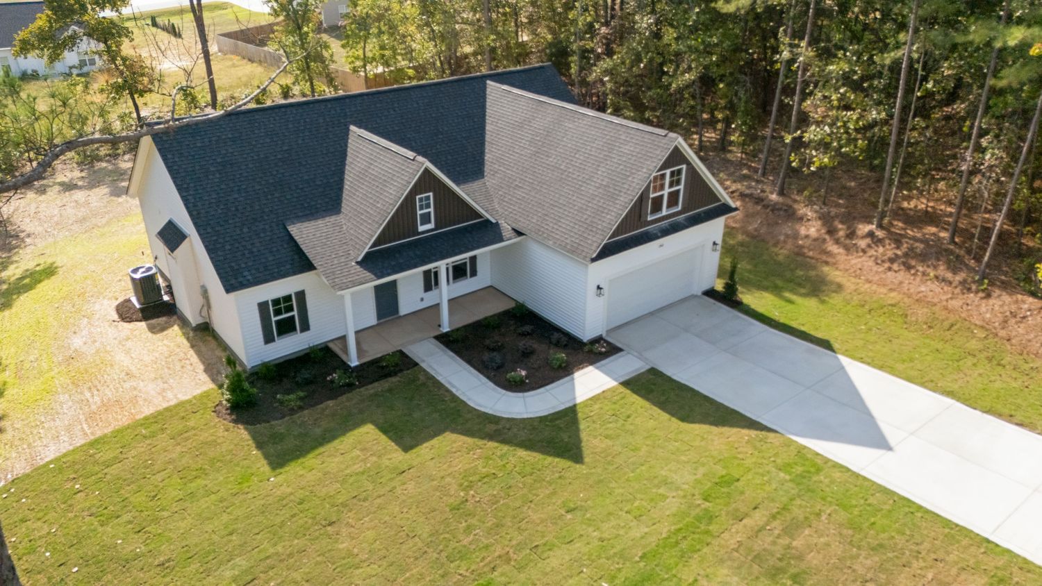
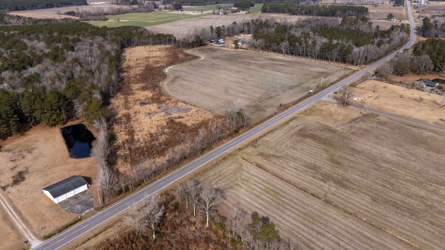
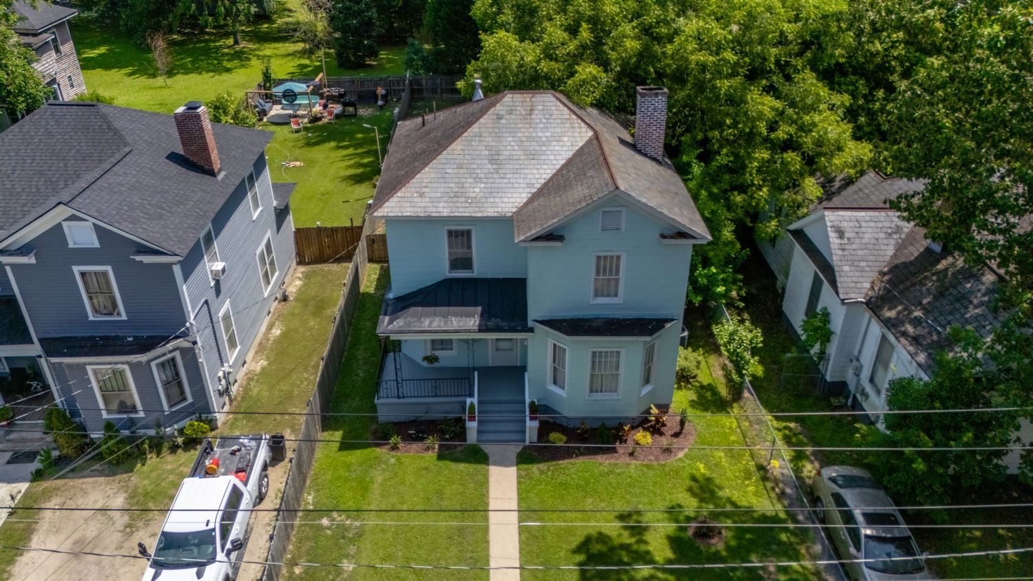
Show More With Professional Aerial Photography
Some properties and locations can’t be fully understood from ground-level photos alone. Drone photography gives buyers and clients a clear view of:
- Property layout
- Lot size and boundaries
- Surrounding area
- Access points and proximity
It adds context, clarity, and visual impact — without overcomplicating the listing or marketing.
That’s why drone photography has become a must-have for real estate and commercial projects.
Drone Photography for Real Estate & Businesses
We provide professional drone photography in Fayetteville, NC for both real estate and commercial use.
Real Estate Drone Photography
Ideal for:
- Residential listings
- Luxury homes
- Land and acreage
- New construction
Aerial images help listings stand out online and give buyers a better understanding of the property before they ever visit in person. Drone photography can also be added to our professional real estate photography in Fayetteville, NC to create a more complete view of the home, property, and surrounding area.
Commercial & Business Drone Photography
Perfect for:
- Commercial properties
- Construction projects
- Marketing and promotional use
- Business locations and facilities
Professional aerial imagery helps businesses showcase properties, construction projects, and facilities by showing scale, layout, and location in ways ground-level photography can’t.
What Makes Our Drone Services Different
Drone photography should add value — not distractions.
We focus on:
✅ Clean, well-composed aerial images
✅ Views that highlight the property, location and surrounding area
✅ Professional flight planning and execution
✅ Consistent quality from shoot to shoot
✅ Fast turnaround so your marketing stays on schedule
Every flight is planned with purpose, giving you aerial images that support your listing, property, or business—not just another set of drone photos.
Safe, Professional, and Reliable
Drone photography requires more than simply putting a drone in the air. Every flight is carefully planned with safety, airspace, weather, and the property in mind.
As an FAA Part 107 certified drone pilot, D2LifePhotography provides professional aerial photography while following FAA regulations and applicable airspace requirements.
From residential listings to commercial properties and construction projects, you can feel confident that your drone photography is handled safely, professionally, and with attention to detail.
Why Choose D2LifePhotography
Great drone photography is about more than getting a camera in the air. It’s about knowing which angles help tell the story of a property and creating images that are useful for your marketing.
When you work with D2LifePhotography, you get:
- Real Estate Experience — We understand how to photograph properties from the air to highlight the home, lot, location, and surrounding area.
- Fast Turnaround — Get your finished images quickly so you can keep listings and marketing projects moving.
- Consistent, Professional Results — Clean, polished aerial images that match the quality of your ground-level photography.
- One Reliable Media Partner — Combine drone photography with professional listing photos, video, 3D tours, and other real estate media without coordinating multiple vendors.
Whether you’re marketing a home, commercial property, construction project, or business, our goal is simple: make the process easy and give you professional aerial images you can put to work.
Drone Photography FAQs:
How much does drone photography cost in Fayetteville, NC?
Drone photography pricing depends on the property and the scope of the project. For real estate listings, aerial photography can be added to a photography session, while commercial and larger projects may require a custom quote. Contact D2LifePhotography for current drone photography pricing in Fayetteville, NC.
Can drone photography be added to a real estate photography package?
Yes. Drone photography can easily be added to your real estate photography session. Combining professional ground-level photos with aerial images gives buyers a more complete view of the home, property, lot, and surrounding area—all during one scheduled appointment.
Are you FAA certified to provide commercial drone photography?
Yes. D2LifePhotography provides commercial drone photography through an FAA Part 107 certified remote pilot. Flights are planned and conducted in accordance with FAA regulations and applicable airspace requirements.
Can you fly a drone anywhere in Fayetteville, NC?
Not always. The Fayetteville area has complex airspace due to Fort Bragg and the Fayetteville Regional Airport. Depending on the location, drone operations may be within controlled or restricted airspace and may require FAA authorization or have specific flight limitations.
Before each shoot, we check the airspace and determine what is required for a safe and legal flight. When authorization is available, we handle the necessary flight planning so our clients don't have to navigate the process themselves.
What happens if the weather isn't suitable for drone photography?
Safety and image quality come first. High winds, rain, poor visibility, or other unsafe conditions may require us to delay or reschedule the aerial portion of a shoot. If conditions aren't suitable, we'll work with you to find the best option for completing the drone photography.
How quickly will I receive my drone photos?
Drone images are professionally edited and delivered with the rest of your project whenever possible. Most real estate photography projects are delivered the next day, helping you get your listing online and in front of buyers quickly.
Do you provide drone photography for commercial properties and construction projects?
Yes. We provide aerial photography for commercial properties, construction projects, business locations, land, facilities, and other commercial uses. Drone imagery is especially useful for showing property layout, scale, surrounding development, and features that are difficult to capture from ground level.
What types of properties benefit most from drone photography?
Drone photography can benefit almost any property, but it's especially effective for homes with acreage, large lots, luxury properties, land, new construction, commercial properties, and properties where location or surroundings are an important selling point. Aerial photography helps viewers understand how the property fits into the bigger picture.
Ready to Add a Better View to Your Marketing?
Professional aerial photography for real estate, commercial properties, land, and construction projects throughout the Fayetteville area.
Professional Real Estate photographers in the Fayetteville, NC area specializing in Real Estate, Headshots, Portraits, Social Media and photo editing.
Providing Real Estate Photography in the following areas in North Carolina: Fayetteville, Fort Bragg, Spring Lake, Sanford, Hope Mills, Raeford, Lillington, Lumberton, Dunn, Pinehurst, Southern Pines, Raleigh, Fuquay-Varina, Laurinburg, Eastover, Vander, Anderson Creek, Wilmington, NC - and all points in between.